


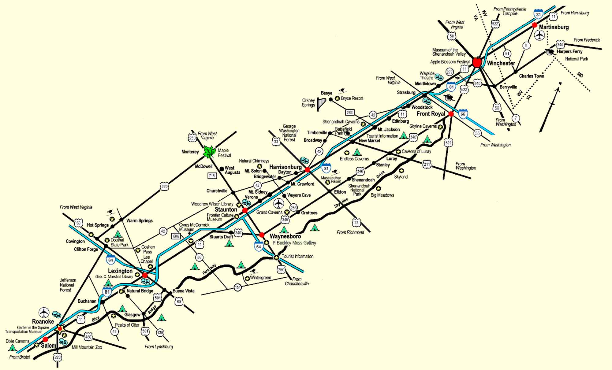


Map of the Shenandoah Valley (not to scale)
Copyright © 1988-2026
Shenandoah Valley Monthly CLICK FOR I-81 and I-64 EXITS
All rights reserved
The Shenandoah Valley lies between the Blue Ridge Mountains to the east and the Allegheny Mountains to the west. It stretches approximately 200 miles from Harpers Ferry, West Virginia to Roanoke, Virginia.

This is a state map indicating where
the Shenandoah Valley is located.